Google Maps has gained three new features to help users stay safe during this pandemic-affected holiday season. The update includes an expansion of Google’s live transit “crowdedness” status information, an expanded COVID-19 overlay, and the live status of takeout and delivery in some countries.
The app’s crowdedness data displays the crowdsourced real-time state of transit lines when users look up directions. The feature relies on in-app feedback from users and has been expanded to include buses, trains, and subways.
Avoiding holiday crowds might have always been your thing, but this year, we’re making it especially easy for everyone. If you need to take transit, Google Maps can help you more easily social distance with live crowdedness information. On Android and iOS globally, you’ll start seeing how crowded your bus, train, or subway line is right now based on real-time feedback from Google Maps users around the world (wherever data is available).
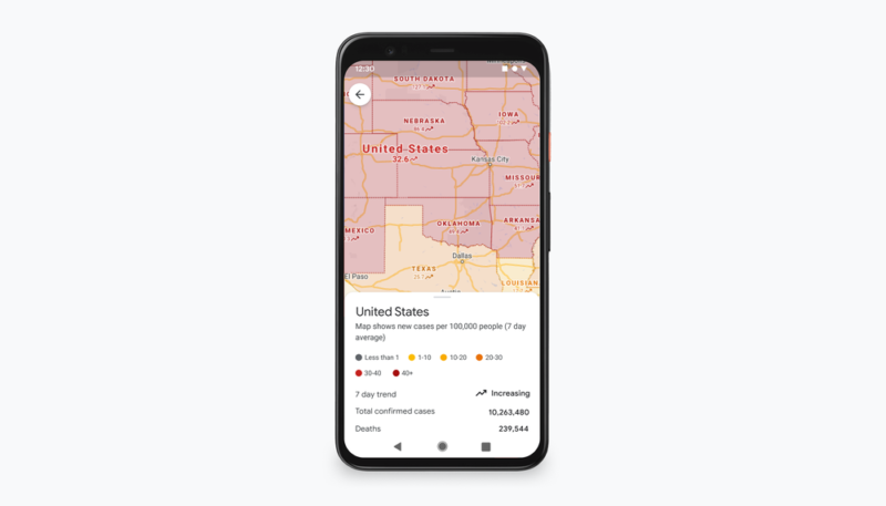
Google Maps’ COVID-19 overlay, originally rolled out in September originally displayed trending cases in an area (seven-day average of cases per 100,000 people and whether cases are rising and falling), allowing Google Maps users to make informed decisions about traveling to an area. The feature now offers the all-time number of confirmed cases and deaths, with links to local resources.
Last but certainly not least for many Google Maps users, Google is rolling out the ability to see the live status of takeout and delivery orders in the United States, Canada, Germany, Australia, Brazil, and India when you book or order from Google Maps on Android and iOS.
Now, users can know when to pick up their food, or when they can expect it to arrive at their doorstep. Expected wait times and delivery fees are also shown, and favorites can be reordered right from the Google Maps app.
Google Maps is free and is available for free in the App Store. [GET IT HERE]


